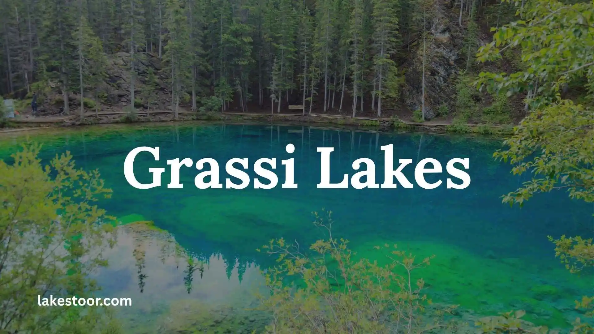
Grassi Lakes is one of the most famous short hikes near Canmore, Alberta, known for its striking turquoise lakes, Rocky Mountain scenery, waterfall views, and relatively accessible trail. Under normal conditions, the hike is a popular choice for families, beginners, photographers, and travelers who want a memorable mountain experience without committing to a full-day trek.
However, there is an important update for anyone planning a trip in 2026: Grassi Lakes is currently closed until further notice because of a June 2026 rockslide and associated slope-stability concerns. The closure includes the Grassi Lakes Day Use Area, Interpretive Trail, Upper Trail, and surrounding access.
That means this guide is useful both for understanding the trail and for planning a future visit—but you should always check the latest official status before travelling.
Grassi Lakes at a Glance
| Feature | Details |
| Location | Near Canmore, Alberta, Canada |
| Area | Canmore / Kananaskis region |
| Main attraction | Two turquoise alpine lakes |
| Trail options | Upper Trail and Interpretive Trail |
| Typical overall distance | About 4 km return/loop, depending on route |
| Typical hiking time | About 1–2 hours, with longer visits possible |
| Difficulty | Easy to intermediate, depending on route |
| Elevation gain | Sources vary by route and measurement; roughly 125–170 m is commonly listed |
| Main highlights | Turquoise lakes, waterfall, mountain views, forest and cliffs |
| Family friendly | Yes, under normal trail conditions |
| Public transit | Roam Route 12 normally provides seasonal service |
| Current 2026 status | Closed until further notice |
Travel Alberta describes the hike as approximately 4 km and 1–2 hours, while Alberta Parks information distinguishes between the easier Upper Trail and the more challenging Interpretive Trail.
What Are Grassi Lakes?
Grassi Lakes are two small, vivid turquoise lakes located in the mountains above Canmore. Their intense blue-green appearance contrasts dramatically with the surrounding limestone cliffs, evergreen forest, and Rocky Mountain landscape.
The lakes are the destination of two established hiking routes. The easier route follows an old road through forest, while the Interpretive Trail provides a more challenging climb with waterfall and valley views.
The hike’s combination of short distance + dramatic scenery + proximity to Canmore is what makes Grassi Lakes so popular.
It is not a wilderness expedition requiring an entire day. Instead, it is the kind of trail that can fit into a morning, afternoon, or larger Canadian Rockies itinerary.
Where Is Grassi Lakes?
Grassi Lakes is located near Canmore, Alberta, in the Canadian Rockies.
The trailhead is associated with Ken Ritchie Way and the Spray Lakes Road area, west of Canmore.
For visitors staying in Canmore, the location is particularly convenient because the trail is only a short distance from town.
The area is also connected to the broader Canmore Nordic Centre and Kananaskis trail network.
Getting to Grassi Lakes From Canmore
Under normal conditions, drivers travel toward the Canmore Nordic Centre and continue toward the Grassi Lakes access area.
However, do not attempt to drive to the trailhead during the current closure. Access roads and the surrounding area have been affected by the 2026 rockslide closure.
When the area eventually reopens, follow the current directions and access instructions from Alberta Parks rather than relying on an older map or travel article.
Is Grassi Lakes Trail Open Today
Grassi Lakes Trail conditions can change quickly, so visitors should check the latest Alberta Parks closure information before starting the hike. This is especially important in 2026 because the Grassi Lakes area experienced a significant closure following rockfall and slope-stability concerns.
Recent September 2026 visitor reports indicate that the trail had reopened, with hikers reporting successful visits in early September. However, online map listings can sometimes remain outdated or show confusing closure information.
For the most reliable answer on the day of your visit, check the current Alberta Parks notices and on-site signs before entering the trail. Never use an old blog post or social media comment as confirmation that a closed area is safe.
Grassi Lakes is a popular hike, so an early start can also help with parking and crowds. The Town of Canmore recommends planning ahead and notes that seasonal Roam Route 12 provides service to Grassi Lakes from May through October.
Grassi Lakes Directions
Grassi Lakes is located near Canmore, Alberta, within the Canmore Nordic Centre Provincial Park area. The Grassi Lakes trailhead is accessed from Highway 742, also known as the Smith-Dorrien/Spray Trail.
From Canmore, follow the signs toward the Canmore Nordic Centre and continue toward the Grassi Lakes access area. Alberta Parks identifies a dedicated trailhead parking facility near Highway 742.
If you are driving from Calgary, take the Trans-Canada Highway toward Canmore and then follow local directions toward the Canmore Nordic Centre and Highway 742.
Parking can become busy because Grassi Lakes is one of the area’s most popular short hikes. During the warmer months, the Town of Canmore also provides seasonal free Roam transit service to Grassi Lakes, which can be a useful alternative when parking is limited.
Why Is Grassi Lakes Closed
Grassi Lakes has experienced closures for several different reasons, including seasonal conditions, wildlife concerns, maintenance, and, most importantly recently, rockfall and slope instability.
In June 2026, Alberta Parks closed the Grassi Lakes day-use area and several surrounding trails after a rockslide and concerns about unstable rock. The closure affected the Grassi Lakes Upper Trail, Grassi Lakes Interpretive Trail, Reclaimer Trail, the day-use area, and nearby access routes.
The reason for a closure is not always obvious from the trail itself. Rockfall can occur above a trail, meaning a route that looks perfectly walkable may still be dangerous.
For that reason, hikers should never bypass a closure barrier. In 2026, authorities also warned visitors about entering closed areas while rock-stabilization work was underway.
Grassi Lakes Location
Grassi Lakes is near Canmore, Alberta, in the Canmore Nordic Centre Provincial Park area. The trailhead is located close to Highway 742, south of the main Canmore townsite.
The location makes Grassi Lakes an easy destination to combine with other Canmore-area attractions. From the trail, visitors can enjoy views of the Rocky Mountains, surrounding forest, cliffs, and the Bow Valley.
Alberta Parks lists the Grassi Lakes trail as a 3.5-kilometre return route with approximately 125 metres (410 feet) of elevation gain.
Despite its relatively short distance, the trail should not be treated as a completely effortless walk. The more difficult route contains steeper sections, and wet, icy, or snowy conditions can make the terrain harder.
Grassi Lakes Winter
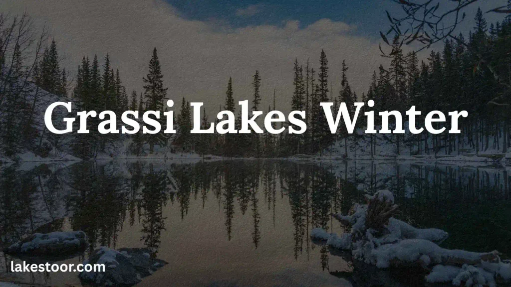
Grassi Lakes can be beautiful in winter, but snow and ice can change the difficulty of the hike significantly. The easier route follows an old road through the forest, while the more difficult interpretive route has steeper terrain.
Winter hikers should expect icy sections, packed snow, and changing trail conditions. Microspikes or similar traction equipment can be useful when the trail is icy. Recent local winter discussions have also reported icy conditions on the route.
Winter daylight is shorter, so leave enough time to complete the hike before dark. Dress in layers, carry appropriate winter gear, and check the latest trail and weather information before leaving Canmore.
Wildlife awareness is important throughout the year. Alberta Parks advises visitors to travel in groups when possible, make noise, carry bear spray, and keep pets on a leash in the area.
Grassi Lakes Weather
Weather around Grassi Lakes can change quickly because the trail is in the Rocky Mountain environment. A sunny morning in Canmore does not guarantee identical conditions on the trail.
Rain can make rocks and roots slippery, while colder temperatures can create ice. In autumn and winter, snow may appear on higher surrounding peaks even when conditions in town are relatively mild.
Before hiking, check the Canmore-area forecast as well as trail conditions. Pay attention to temperature, precipitation, wind, visibility, and any warnings.
Thunderstorms also deserve extra attention because mountain weather can develop quickly. If conditions become unsafe, turning around is better than trying to complete the hike simply because you have already started.
Grassi Lakes Reddit
Reddit can be useful for finding recent visitor experiences, but it should be treated as a supplementary source, not the final authority on trail closures.
Recent September 2026 discussions in the Banff subreddit included visitors asking about the Grassi Lakes trail. Multiple commenters reported that the trail was open and that they had recently completed the hike successfully.
At the same time, earlier 2026 Reddit discussions documented the lengthy closure caused by rockfall and unstable slopes.
This difference shows why Reddit posts can become outdated quickly. A comment from June may describe a completely different situation from one in September.
Use Reddit for recent hiking impressions, parking experiences, trail conditions, and practical tips, but verify current closures through Alberta Parks before setting out.
Grassi Lakes Trail Turquoise Water
The turquoise and aquamarine color of Grassi Lakes is one of the main reasons the hike is so popular. Alberta Parks describes the lakes as shallow, aquamarine lakes surrounded by Rocky Mountain scenery.
The striking color comes from the interaction of light with the lake water and fine particles and minerals associated with the surrounding mountain environment. The result can range from blue-green to bright turquoise depending on sunlight, weather, viewing angle, and seasonal conditions.
The color is often most impressive when sunlight reaches the water. On cloudy days, the lakes may appear darker or less vibrant.
Visitors should stay on designated trails and viewing areas rather than approaching unstable edges or climbing around the lakes for a better photograph. Grassi Lakes is also located within a wildlife corridor, where travel is restricted to designated trails.
Grassi Lakes Viewpoint
The Grassi Lakes hike offers more than the lakes themselves. Along the route, hikers can enjoy views toward the surrounding mountains and the Bow Valley.
The more difficult Grassi Lakes Interpretive route climbs through forested terrain and includes a steep section with views of a waterfall and the town of Canmore. Alberta Parks lists the interpretive route at approximately 3.5 km return with 125 m of elevation gain.
At the lakes, the combination of turquoise water, rocky cliffs, evergreen forest, and mountain scenery creates one of the area’s most recognizable viewpoints.
For photography, early morning or later afternoon can provide softer light and fewer people. Always remain on designated routes and use established viewing areas.
Grassi Lakes Alberta
Grassi Lakes is one of the best-known short hikes near Canmore, Alberta. The destination consists of two small aquamarine lakes surrounded by forest, cliffs, and Rocky Mountain scenery.
The trail is part of the Canmore Nordic Centre Provincial Park area and passes through a wildlife corridor. Alberta Parks specifically notes that visitors must remain on designated trails in this corridor.
The hike is relatively short, making it attractive for visitors who want a mountain experience without committing to a full-day backcountry route. However, popularity also means parking and trail congestion can be issues during busy periods.
The area also has important natural and cultural features, including limestone formations, a major waterfall, and historic rock paintings.
Grassi Lakes Banff
Grassi Lakes is often searched as “Grassi Lakes Banff,” but the location should be described accurately. Grassi Lakes is near Canmore, Alberta, rather than inside the town of Banff.
The confusion is understandable because Canmore and Banff are both major gateways to the Canadian Rockies, and many visitors stay in Banff while exploring destinations around Canmore.
If you are traveling from Banff, you can reach the Canmore area by following the Trans-Canada Highway east toward Canmore and then continuing toward the Grassi Lakes trailhead.
For an article, it is useful to include the phrase “Grassi Lakes Banff” because people search for the destination this way, while clearly explaining that the trail is located near Canmore.
Grassi Lake Hiking
Grassi Lakes hiking is a relatively short Rocky Mountain adventure with two distinctly different route options. Alberta Parks identifies the easier Grassi Lakes route and the more difficult interpretive route.
The easier route follows an old road through dense forest and is generally the more straightforward option. The interpretive route provides additional scenery and information but includes steeper terrain.
The official trail information gives the route a length of about 3.5 km return and 125 m of elevation gain.
Even though the distance is modest, conditions can change the experience. Rain, snow, ice, wildlife activity, and temporary closures can all affect the hike.
Carry water, wear suitable footwear, stay on marked trails, and check current Alberta Parks information before visiting. The reward is a scenic pair of aquamarine lakes with dramatic Rocky Mountain surroundings.
Grassi Lakes Directions
For visitors starting in Canmore, the basic route is to head toward the Canmore Nordic Centre and Highway 742, then follow signs for the Grassi Lakes trailhead. The official Alberta Parks map identifies the Grassi Lakes parking area near Highway 742.
If you do not want to drive, seasonal Roam Route 12 connects Canmore with Grassi Lakes from May through October. The service is designed to reduce parking pressure at popular destinations and provides another way to reach the area.
Because access conditions can change during construction, severe weather, or safety closures, check the latest road and park notices immediately before your trip. Do not rely solely on an old GPS route.
Is Grassi Lakes Open in 2026?
No. Grassi Lakes is currently closed until further notice as of August 2026.
Alberta Parks closed the area after a June 2026 rockslide. The closure includes:
- Grassi Lakes Day Use Area
- Grassi Lakes Interpretive Trail
- Grassi Lakes Upper Trail
- Reclaimer Trails
- Portions of surrounding access
The closure was implemented because of rockslide and slope-stability concerns.
This is the most important information to know before planning a Grassi Lakes hike in 2026.
Do not enter a closed area, even if older websites or social-media posts show people hiking there.
How Long Is the Grassi Lakes Hike?
Under normal conditions, the complete Grassi Lakes outing is generally around 4 km (2.5 miles), depending on the route and whether you complete a loop or return along the same trail. Travel Alberta lists approximately 4 km and 1–2 hours.
Different trail resources report somewhat different distances and elevation figures because they may measure slightly different route combinations.
For planning purposes, a useful expectation is:
- Distance: about 4 km
- Time: approximately 1–2 hours of hiking
- Difficulty: easy on the easier route; intermediate on the Interpretive route
- Elevation: roughly 125–170 m depending on the route/source
If you hike slowly, take photographs, enjoy the lakes, or stop for breaks, allow additional time.
How Hard Is Grassi Lakes?
One of the reasons Grassi Lakes attracts so many visitors is that it offers impressive scenery without the distance of a major mountain hike.
But the difficulty depends on which route you use.
Grassi Lakes Upper Trail
The Upper Trail is the easier option. Alberta Parks describes it as following an old road through dense forest.
This is generally the better choice for:
- Beginners
- Families
- Visitors who prefer a gradual climb
- Hikers who want the simplest route
- People with limited hiking experience
The route still involves uphill walking, so “easy” should not be interpreted as completely flat.
Grassi Lakes Interpretive Trail
The Interpretive Trail is more challenging.
It climbs through forest and reaches a steeper section with views of a waterfall and Canmore. Alberta Parks identifies this route as intermediate and notes approximately 125 m of elevation gain in its trail information.
It is a better choice for hikers who want:
- More challenging terrain
- Waterfall scenery
- Views toward Canmore and the Bow Valley
- A more interesting climbing experience
The Interpretive Trail is also subject to seasonal restrictions and should only be used when officially open and safe.
What Is the Grassi Lakes Trail Like?
The trail begins in a forested mountain environment and gradually gains elevation toward the lakes.
The experience changes as you climb.
At first, the forest dominates the landscape. As you gain elevation, mountain views begin opening up. On the Interpretive route, the waterfall and viewpoints add additional interest before you reach the lakes.
Eventually, the forest opens around the turquoise water, revealing the distinctive cliffs and mountain scenery that make Grassi Lakes famous.
The destination feels much more dramatic than the relatively short approach might suggest.
Why Are Grassi Lakes So Blue?
The turquoise color is one of the main reasons people search for and photograph Grassi Lakes.
The color comes from the interaction of light with minerals and fine particles in the water. The result is an intense blue-green appearance that can look almost unreal against the surrounding rock and forest.
Water color can vary with lighting, weather, season, and viewing angle, so photographs taken on different days may look surprisingly different.
What Can You See at Grassi Lakes?
The Two Turquoise Lakes
The lakes themselves are the main attraction.
Their vivid color contrasts with the surrounding limestone cliffs and evergreen forest, producing one of the most recognizable landscapes near Canmore.
Waterfall
The Interpretive Trail provides views of a waterfall during the ascent.
Water levels and appearance naturally change throughout the year, so the waterfall may look very different in spring, summer, fall, and winter.
Canmore and Bow Valley Views
The more challenging route provides viewpoints toward Canmore and the Bow Valley.
These views are an important reason some hikers prefer the Interpretive Trail when it is open.
Limestone Cliffs
The cliffs surrounding the lakes create a dramatic backdrop and are also associated with rock climbing.
Visitors should respect climbing areas and never approach unstable rock or restricted zones.
Also Check This Post: Green Lakes Trail: Complete Hiking Guide to Green Lakes in Oregon
Best Time to Visit Grassi Lakes
The best time depends on the experience you want—and whether the trail is officially open.
Summer
Summer is normally the most popular season.
You can expect:
- Longer daylight hours
- Green vegetation
- More comfortable hiking conditions
- Strong turquoise colors
- Busy trails
The major disadvantage is crowds.
Canmore itself advises visitors to start early or travel during off-peak hours to avoid congestion.
Fall
Fall can provide cooler temperatures and changing foliage.
The contrast between autumn colors, turquoise water, and mountain rock can make this an excellent photography season.
Winter
Winter changes the experience considerably.
Snow and ice can make the trail more difficult, and equipment such as microspikes may be appropriate on icy sections.
Travel Alberta notes that the easier route can remain available in winter under normal conditions, while the Interpretive Trail has winter restrictions.
Always check current trail conditions before winter hiking.
Spring
Spring can bring changing trail conditions, melting snow, mud, and slippery sections.
Rather than assuming the trail is ready because temperatures have warmed in Canmore, check the official trail report before leaving.
What Is the Best Time of Day to Hike Grassi Lakes?
When the trail is open, early morning is generally the best choice for visitors who want fewer crowds and easier parking.
Early starts also give you more flexibility if you want to spend additional time photographing the lakes or exploring other Canmore attractions afterward.
Canmore’s visitor guidance specifically recommends getting an early start or visiting during off-peak hours to beat the crowds.
Midday during a summer weekend is typically a less desirable option if your priority is solitude.
Parking at Grassi Lakes
Parking is one of the practical issues visitors should consider because Grassi Lakes is extremely popular.
The Town of Canmore advises visitors not to park on shoulders or roadways when a parking location is full. Instead, visitors should consider other transportation options or have a backup plan.
During the current 2026 closure, however, visitors should not travel to the closed trailhead simply to look for parking.
When the area reopens, check current parking rules and access information because arrangements can change.
Can You Take Public Transit to Grassi Lakes?
Normally, yes.
Roam Transit Route 12 provides seasonal service between downtown Canmore and Grassi Lakes, along with stops serving places such as Quarry Lake and the Canmore Nordic Centre. Canmore states that local Roam service is free.
However, there is an important current restriction: Roam’s latest service update says Route 12 is not currently accessing the Grassi Lakes trailhead because of environmental hazards on the road.
Therefore, do not assume that a normal summer schedule means the bus is currently reaching the trailhead.
Is Grassi Lakes Family Friendly?
Under normal conditions, yes, the easier route is a popular family hiking option.
Travel Alberta specifically describes Grassi Lakes as a short, picturesque trail that is great for families.
Families should still consider:
- Children’s hiking ability
- Weather
- Trail conditions
- Steep sections
- Ice and snow
- Wildlife
- Exposure around cliffs and rock
The Interpretive Trail is less suitable for very young children or anyone uncomfortable with steeper terrain.
And, most importantly, families should not enter the area while it remains closed.
Can You Bring Dogs to Grassi Lakes?
Dog rules can depend on the current trail and wildlife restrictions.
Canmore advises visitors to keep dogs leashed outside designated off-leash areas because dogs can disturb wildlife.
Before bringing a dog after the trail reopens, check the current Alberta Parks rules and any wildlife advisories.
Do not bring a dog into a closed area.
Is Grassi Lakes Accessible for Strollers or Wheelchairs?
Grassi Lakes should not be treated as a fully accessible wheelchair trail.
The route includes uneven natural surfaces and uphill sections, and the Interpretive Trail contains steeper terrain and stairs.
Some visitors may manage portions of the easier route with suitable equipment, but conditions vary.
If accessibility is an important requirement, verify current trail conditions and accessibility information before visiting rather than relying on generic “easy hike” descriptions.
Is There a Fee for Grassi Lakes?
Access rules and provincial-park requirements can change, so visitors should check the current Alberta Parks and Canmore information before travelling.
Canmore also notes that Alberta Parks has implemented a permit system in the area and that license plates are scanned at Grassi Lakes and the Canmore Nordic Centre.
Because the area is currently closed, do not plan a visit based on older fee or parking information.
What Should You Bring?
When the trail is open, Grassi Lakes does not require a huge amount of specialized equipment, but a sensible day-hiking setup is recommended.
Bring:
- Water
- Snacks
- Comfortable hiking footwear
- Weather-appropriate layers
- Rain or wind protection
- Sun protection
- A charged phone
- Offline maps
- Bear spray where appropriate
- Microspikes during icy conditions
- Hiking poles if useful for balance
Mountain weather can change quickly, even when conditions in Canmore look pleasant.
Wildlife and Bear Safety
Grassi Lakes is in a mountain environment where wildlife awareness is important.
Canmore recommends travelling in groups, carrying bear spray, keeping dogs leashed outside designated off-leash areas, and staying out of designated wildlife corridors and closed areas.
If the trail reopens, check the latest wildlife alerts before starting your hike.
Never approach wildlife for photographs, feed animals, or leave food and garbage behind.
Also Check This Post: High Lakes Loop Trail: Complete Hiking Guide to Distance, Difficulty, Route, Lakes, and Views
Grassi Lakes Safety Tips
A safe visit begins before you reach the trail.
Check the Official Status
This is especially important in 2026.
The trail is currently closed because of rockslide and slope-instability concerns.
Do not rely on an old blog post, Google Maps review, Instagram photograph, or previous hiking experience to determine whether the trail is open.
Stay on Designated Trails
The Grassi Lakes area is within a wildlife corridor, and Alberta Parks restricts travel to designated trails.
Do not create unofficial shortcuts.
Watch for Ice
During cold seasons, natural ice can make apparently easy terrain dangerous.
Microspikes and poles can be useful when conditions warrant them.
Respect Closures
A closure is not a suggestion.
If Alberta Parks has closed the area, wait for the official reopening.
Grassi Lakes vs. Other Canmore Hikes
Grassi Lakes is particularly appealing because of its short distance and dramatic destination.
| Hike Type | Grassi Lakes Advantage |
| Short scenic hike | Excellent |
| Family outing | Good on easier route |
| Waterfall views | Yes |
| Turquoise lake scenery | Excellent |
| Big elevation challenge | No |
| Solitude | Usually poor during peak periods |
| Photography | Excellent |
| Beginner-friendly | Generally yes on easier route |
| Full-day adventure | Better options exist |
If your goal is maximum scenery for relatively little hiking, Grassi Lakes is hard to beat.
If your goal is solitude, a major summit, or a long backcountry adventure, another Canmore-area trail may be a better fit.
What to Do Instead While Grassi Lakes Is Closed
Because Grassi Lakes is currently closed, travelers should have a backup plan.
Nearby Canmore offers many other walking and hiking opportunities. The Town of Canmore lists trails including the Policeman’s Creek Loop, Engine Bridge Loop, East Bow River Trail, North Bow River Trail, Quarry Lake Loop, and West Bow River Pathway.
One particularly easy alternative is Policeman’s Creek Loop, which is 1.24 km and generally takes 15–30 minutes. The Engine Bridge Loop is another scenic option, covering about 2.03 km.
Always verify that your chosen alternative is open and suitable for current conditions.
Grassi Lakes Photography Tips
Grassi Lakes is an excellent destination for landscape photography when open.
For the best results:
- Visit early to reduce crowds.
- Photograph the lakes from designated viewpoints.
- Include surrounding cliffs for scale.
- Try wider compositions that show the forest and mountains.
- Photograph in changing light rather than relying only on bright midday conditions.
- Avoid stepping into restricted or environmentally sensitive areas for a better angle.
The turquoise water is already the visual centerpiece, so simple compositions often work best.
Is Grassi Lakes Worth Visiting?
Absolutely—when it is open and safe.
Grassi Lakes offers an unusually high scenic payoff for a short hike. You get turquoise lakes, mountain scenery, forest, cliffs, and waterfall views without needing to spend an entire day on the trail.
It is particularly worthwhile for:
- First-time visitors to Canmore
- Families
- Beginner hikers
- Photographers
- Travelers with limited time
- Visitors looking for a short Rocky Mountain hike
Its popularity is also its biggest drawback. During busy periods, the experience can feel crowded.
Frequently Asked Questions About Grassi Lakes
How far is Grassi Lakes from Canmore?
Grassi Lakes is located just outside Canmore in the Canadian Rockies and is easily associated with the Canmore trail network. The trailhead is on Ken Ritchie Way in the Grassi Lakes area.
How long does the Grassi Lakes hike take?
The typical outing is around 1–2 hours, although visitors who take photographs and spend time at the lakes may want longer. Travel Alberta lists the hike at about 4 km.
Is Grassi Lakes an easy hike?
The easier Upper Trail is classified as easy, while the Interpretive Trail is more challenging and includes a steep section.
Is Grassi Lakes open right now?
No. As of August 2026, Grassi Lakes is closed until further notice because of the June 2026 rockslide and slope-stability concerns.
Can you swim in Grassi Lakes?
Grassi Lakes is primarily a scenic hiking destination. Visitors should follow all current park regulations and posted restrictions and should never enter restricted areas.
Are dogs allowed at Grassi Lakes?
Dog rules should be checked against current Alberta Parks regulations and wildlife advisories. Canmore advises keeping dogs leashed outside designated off-leash areas.
Is Grassi Lakes good for kids?
Yes, under normal conditions the easier route is considered family-friendly. Travel Alberta specifically identifies the trail as a good option for families.
Can you hike Grassi Lakes in winter?
Under normal conditions, the easier route can be used during winter, but ice can make it hazardous and microspikes may be appropriate. The Interpretive Trail has winter restrictions.
Is there public transportation to Grassi Lakes?
Normally, seasonal Roam Route 12 provides free service from Canmore toward Grassi Lakes. However, the current Roam service update says Route 12 is not presently accessing the trailhead because of environmental hazards.
What is the best time to visit Grassi Lakes?
When the trail is open, early morning or off-peak periods are generally preferable for avoiding crowds. Canmore itself recommends getting an early start.
Why are Grassi Lakes turquoise?
The lakes’ distinctive blue-green appearance results from the interaction of light with minerals and fine particles in the water, producing the vivid color for which the destination is famous.
Final Verdict: Should You Put Grassi Lakes on Your Canmore Itinerary?
Grassi Lakes deserves its reputation as one of the most scenic short hikes around Canmore.
The combination of turquoise alpine lakes, dramatic limestone cliffs, waterfall views, forest scenery, and relatively short hiking distance makes it an excellent destination for many types of travelers.
But for anyone planning a trip in 2026, the priority is checking the current closure status. The trail and day-use area remain closed following the June rockslide, and the latest available information does not provide a reopening date.
Once authorities reopen the area, Grassi Lakes can again be considered one of the best short scenic hikes to add to a Canmore itinerary.
Until then, respect the closure, choose an open alternative, and return when Alberta Parks confirms that the area is safe.
Also Check This Post: Blue Lakes Trail Colorado: Complete Hiking Guide

I’m Charlotte Pembroke, and my passion for lakes began through travelling across the United Kingdom’s national parks. I enjoy learning about freshwater ecosystems, famous lakes, conservation, and the unique stories behind these incredible places.
I write to make geography and nature enjoyable for everyone, combining reliable research with clear explanations that readers of all ages can understand.
Books I’ve Written:
- Lakes of Britain: A Natural Journey
- Waters That Shaped History
 Oliver Whitmore